


Login/Sign Up

Study in Germany
Geodesy and Earth Observation
Bachelor's Degree in Engineering
B.Sc. Geodesy and Earth Observation
Campus
Munich
Language
english
Duration
3 Years (6 Semesters)
Credits in ECTS
180 ECTS
Fee
EUR (€) 3,000 per semester for eligible non-EU international students.
Intake
Winter + Summer
English-taught bachelor's programme;
advanced geospatial and satellite technologies;
interdisciplinary engineering education at TUM
Benefits
What's in It for You?

Study at a leading technical university: Gain an engineering education at TUM, a recognised German technical university.
Build geospatial technology expertise: Learn how surveying, satellite measurements and digital mapping support real-world decisions.
Explore Earth observation: Understand how spatial data can be used to study landscapes, environmental changes and natural hazards.
Develop analytical and technical skills: Strengthen your foundations in mathematics, physics, programming and spatial data processing.
Prepare for international career pathways: Explore opportunities in surveying, geospatial engineering, environmental applications and technology development.
Progress to postgraduate study: Build a foundation for related master's programmes and further specialisation in geodesy, geoinformatics and Earth observation.
Need to know more?
Get to know the Technical University of Munich B.Sc. Geodesy and Earth Observation Course in depth by downloading the brochure
Course Details
What Will You Gain from This course
The programme is offered in English from the winter semester 2026/27. TUM lists a standard duration of six semesters, 180 ECTS credits, and an application period that generally runs from 15 May to 15 July.
Degree Awarded: Bachelor of Science (B.Sc.) in Geodesy and Earth Observation.
Study Level: Undergraduate (Bachelor's degree).
Study Mode: Full-time, on-campus.
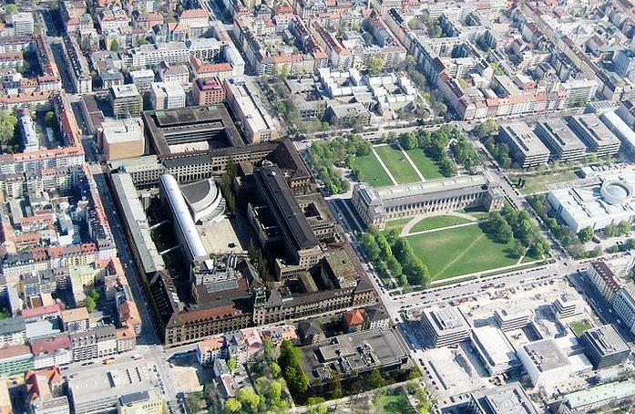
Campus Location: TUM Main Campus, Munich, Germany.
Programme Duration: Six semesters over three years, equivalent to 180 ECTS credits.
Admission Process: Application through TUM online, with an aptitude recommendation procedure and additional documentation where applicable

UniversityPublic
Technical University of Munich
The Technical University of Munich (TUM), founded in 1868, is one of Germany’s leading public research universities, renowned for excellence in engineering, technology, natural sciences, medicine, and business. With campuses across Germany, TUM offers over 170 degree programmes and is recognised for cutting-edge research, innovation, and strong industry partnerships with global companies. Its diverse student community, international outlook, and entrepreneurial culture provide excellent opportunities for academic growth and global career development.
Munich / Garching / Freising / Straubing / Heilbronn, Germany
- Alumni
- 121000+
- Founded
- 1868
- Ranking
- #27
- Intake
- Winter + Summer
- Int'l Students
- 45%
Course Overview
Overview of B.Sc. Geodesy and Earth Observation from Technical University of Munich
The Bachelor of Science in Geodesy and Earth Observation at the Technical University of Munich prepares students to measure, map, analyse and model the Earth using modern surveying equipment, satellite technologies and digital geospatial methods. Combining mathematics, physics, computer science and engineering, the programme covers Geographic Information Systems (GIS), remote sensing, photogrammetry, satellite geodesy and spatial data analysis. Students develop technical and analytical skills relevant to infrastructure development, environmental monitoring, navigation, land management and Earth system research.
Eligibility
Requirements
Academic Requirements
- A recognised higher education entrance qualification equivalent to the German university entrance qualification.
- Academic transcripts and certificates demonstrating previous educational achievement.
- Completion of TUM's applicable aptitude recommendation procedure (Studienorientierungsverfahren or SOV).
- Submission of all required application documents within the official application period.
- Preliminary Documentation (VPD) from uni-assist, where applicable to the applicant's educational background.
- Any additional academic documents or country-specific requirements specified by TUM.
English Language Requirements
- IELTS Academic: Check TUM's current programme-specific requirements before submitting a score.
- TOEFL iBT: Check whether a test score is required for your application.
- Cambridge English qualifications: Confirm acceptance and any applicable score requirements with TUM.
- Other recognised English qualifications: Acceptance depends on TUM's applicable rules.
- Previous education in English: Any exemption or recognition depends on the university's current regulations.
Required Documents
- Higher education entrance qualification (school-leaving certificate or equivalent).
- Academic transcripts and supporting educational records.
- Complete and current CV or résumé.
- Valid passport.
- Letter of motivation in English, as specified by TUM.
- Preliminary Documentation (VPD) from uni-assist, where required.
- Documents required for the aptitude recommendation procedure.
- Additional country-specific documents, if requested.
- Enrolment application, current photograph and health insurance notification, as applicable after admission.
Costs
Tuition & Estimated Cost of Study
| Expense | Estimated cost |
|---|---|
| Tuition Fee (non-EU students) | €3,000 per semester |
| Semester Fee | €97 per semester |
| Accommodation in Munich | €700–€1,300/month |
| Food | €250–€450/month |
| Health Insurance | €120–€150/month |
| Transportation | €38–€60/month |
| Personal Expenses | €200–€350/month |
| Estimated Annual Living CostThese totals exclude tuition and semester fees because those are billed separately. | €15,696–€27,720 per year (estimate) |
- Tuition Fee (non-EU students)€3,000 per semester
- Semester Fee€97 per semester
- Accommodation in Munich€700–€1,300/month
- Food€250–€450/month
- Health Insurance€120–€150/month
- Transportation€38–€60/month
- Personal Expenses€200–€350/month
- Estimated Annual Living Cost€15,696–€27,720 per year (estimate)These totals exclude tuition and semester fees because those are billed separately.
Estimated Tuition for the Full Degree For a standard six-semester degree, the published rate of €3,000 per semester would amount to €18,000 in tuition fees for a student liable for the full fee throughout the programme. This estimate excludes semester contributions and living expenses and assumes the tuition rate remains unchanged.
Work while you study
Student Work Rights
International students studying in Germany may be permitted to work alongside their studies, subject to the conditions of their residence permit and applicable immigration regulations.
- Part-time employment: Students may work within the limits applicable to their immigration status.
- Internships: Internship opportunities may be available through university networks, research groups and employers
- Career support: TUM provides career-related support and access to university resources.
- Post-study opportunities: Eligible international graduates may apply for a residence permit to seek qualified employment in Germany, generally for up to 18 months, subject to the applicable requirements.
Funding
Scholarships for International Students at TUM
Students may be eligible for:
- TUM Scholarships and Tuition Fee Waivers: Explore the university's available funding options and eligibility criteria for international students.
- DAAD Scholarships: Search the German Academic Exchange Service database for funding opportunities relevant to your nationality, academic background and study plans.
- Deutschlandstipendium: Investigate merit-based scholarship opportunities available through participating German universities.
- External Foundations and Funding Organisations: Explore independent scholarship programmes that support eligible students studying in Germany.
Careers
Potential Employers for Geodesy and Earth Observation Graduates
Graduates can work with:
- Surveying and Engineering: Engineering consultancies, land-surveying firms and infrastructure planning organisations.
- Space and Satellite Technology: Satellite operators, aerospace companies and Earth observation research organisations.
- Environmental Monitoring: Environmental agencies, climate research organisations and natural hazard assessment teams.
- Government Mapping and Land Management: Public surveying offices, mapping authorities and land administration bodies
- GIS and Geospatial Software: Geographic information systems, mapping platforms and spatial data technology companies.
- Research and Higher Education: Universities, research institutes and scientific organisations working on Earth systems and geospatial analysis.
Target Audience
Who is this Program For?
This programme may suit: - Students who have completed secondary education and want to pursue an engineering-related bachelor's degree in Germany. - Students interested in mathematics, physics, computer science and Earth sciences. - Aspiring surveying, geospatial technology and GIS professionals. - Students interested in satellite navigation, remote sensing, digital mapping and environmental monitoring. - Future researchers interested in Earth observation, spatial analysis and geospatial engineering. Applicants should review TUM's specific academic eligibility requirements and aptitude recommendation procedure before applying.
Skills
Skills you'll acquire
Geographic Information Systems (GIS)
Satellite Geodesy and Navigation
Remote Sensing and Earth Observation
Surveying and Geospatial Measurement
Spatial Data Processing and Analysis
Photogrammetry and Digital Mapping
1.
What is the B.Sc. Geodesy and Earth Observation programme at TUM?
It is a three-year undergraduate degree that teaches students to measure, analyse and model the Earth using surveying, satellite technologies, geospatial data and digital observation methods.
2.
Is the B.Sc. Geodesy and Earth Observation taught in English?
Yes. TUM states that the updated programme is taught in English from the winter semester 2026/27. Applicants should check the current admission page for the applicable language requirements.
3.
How much is the tuition fee for international students?
The published tuition fee for students from non-EU countries is €3,000 per semester, plus the applicable semester fee. Exemptions and scholarships may be available to eligible students
4.
What are the admission requirements for this bachelor's degree?
Applicants need a higher education entrance qualification recognised for admission to TUM and must follow the applicable aptitude recommendation procedure. International applicants may need preliminary documentation from uni-assist and additional country-specific documents.
5.
What career opportunities are available after graduation?
Graduates may explore careers in geospatial engineering, surveying, GIS, remote sensing, Earth observation, mapping, infrastructure planning and research, depending on their skills and experience.
Frequently asked questions

Contact Us
Have any query, ask here!


Courses
Quick Links
About Us
Blogs
Gallery
Contact Us
Office Addresses
Get Notified Every Time We Post An Offer
